
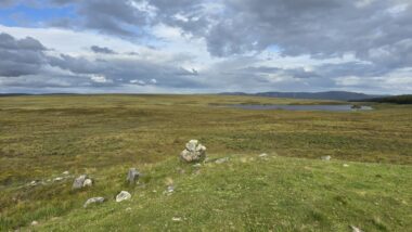
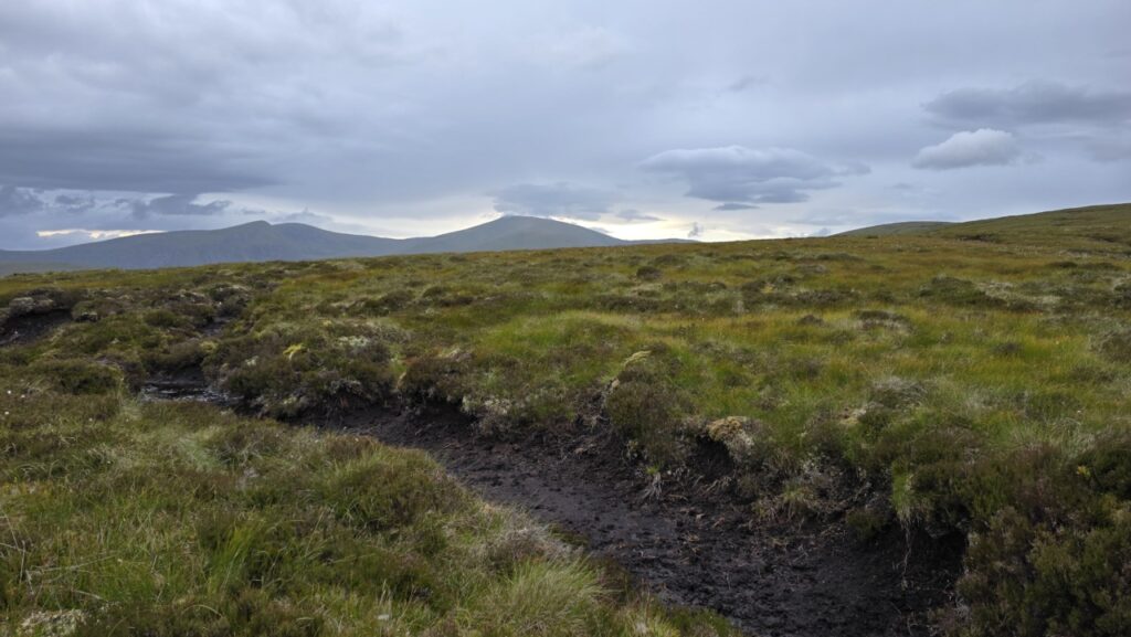
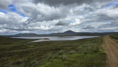
The Flow Country is a vast area of peat bog in northern Scotland, sparsely populated, without major roads but criss-crossed by several minor roads and estate tracks. Its these tracks and the relative remoteness of the area that makes it good for bike-packing. I always prefer a loop when bike-packing, it removes the downer that is often getting to the start/finish, and means that the ride can be started anywhere on said loop, devising this particular loop on Komoot did involve adding some sections where the conditions under tyre were erm ‘unknown’, from satellite photo’s it looked like it would go, but I expected and indeed was dealt some pushing for the mix!
I opted to start at Altnaharra as there is a Caravan and Motorhome Club site there on the shore of Loch Naver, this is a stones throw from the busy NC500, but see’s hardly any tourists, indeed there were only 5 vans on a site that can take 30. While I was faffing about what to take, I enjoyed a lovely view to Ben Klibreck (which I had climbed a couple days earlier). As is now the norm for me, the caravan site provided somewhere secure to abandon my campervan for a few nights!
My dates were 23rd to 26th July. I was thankfully lucky with the midges, and they are not such a bother anyway when you are stopping in bothies. I got fab weather throughout!

This was my first ever proper Bike Packing trip, indeed, I had only bought the kit a month beforehand. I had done road-based cycle touring before as well as hotel-based multi-day mountain bike trips, but never something self-supported in an area where there were few shops for resupply and no easy get-out’s in case of mechanicals. I am no stranger, however to multi-day, self-supported trips having completed a number on foot and by packraft.
I’ve called this journey the Flow Country 360 (FC360), but that’s degrees, not KM! It totals about 290KM as I rode it. I took 4 days as I added on a day to take in the Munro Seana Bhràigh as I was practically going right past it. Adding on the hill-walking bit brings the distance up to 300KM bang on.
I chose to go anti-clockwise, as this put a decent resupply option half way through my 3rd day, while leaving An Turas Mor (mostly) intact for a later adventure as I was going the ‘wrong way’.
If you just want the route map, scroll to the very end!
Day 1 – Altnaharra to School House Bothy
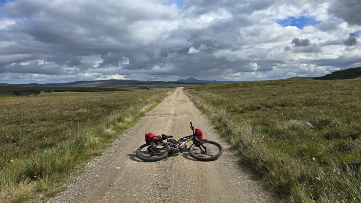
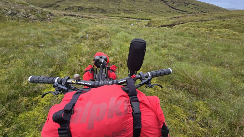
Any expert Bike-Packers reading this will chuckle at the sheer amount of junk attached to my bike! I was planning on using bothies throughout, but had added in a bivvy bag in case things went pear-shaped! I had 4 days food, stove, a load of gadgets and enough battery packs to keep them charged! I also had a lightly loaded rucksack for hill walking purposes.

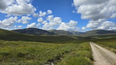
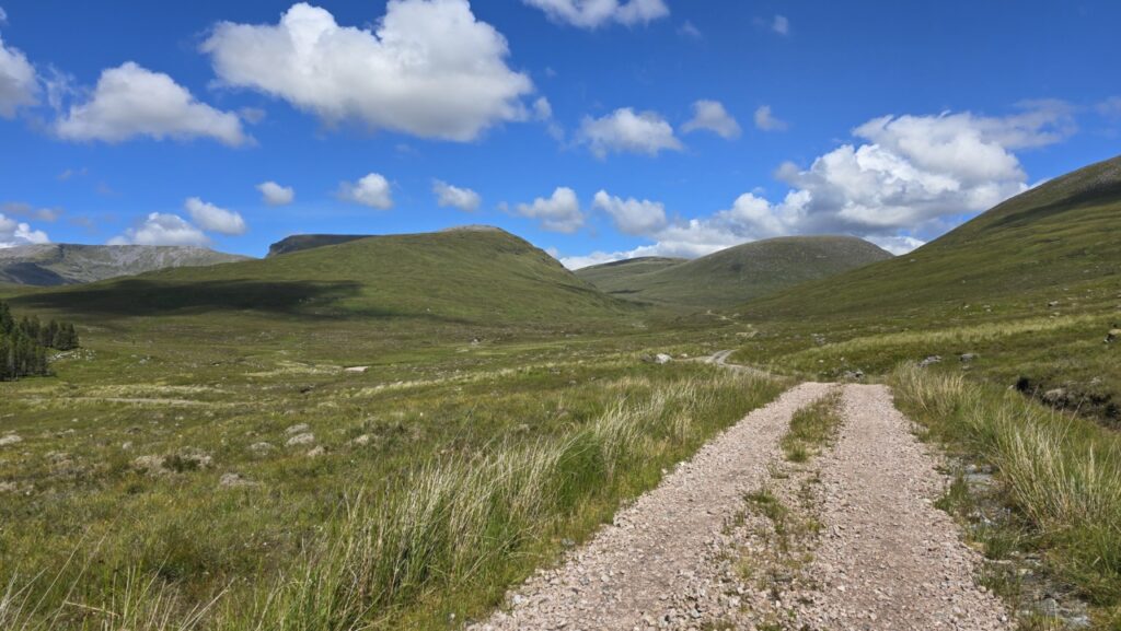
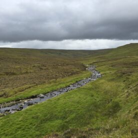
Todays ride took me to School House Bothy for the night, mostly using the route of An Turas Mor, but obviously in reverse, the sun was shining, the roads were deserted, the trails were dusty, and I wasn’t bloody working! Life was good!
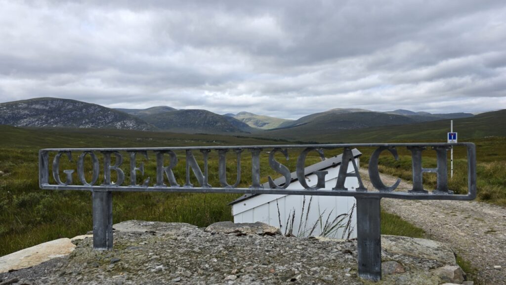
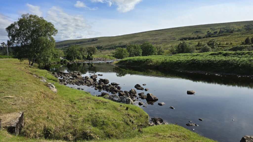
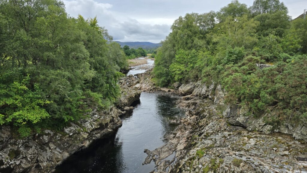
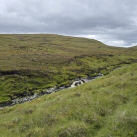
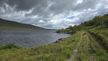
After 19KM of undulating road with ever changing views, I reached the start of the off-road at Gobernuisgach (I suspect its easier to pronounce this after you have had a few!), The track descends to a few houses, most of which look like holiday homes before climbing and becoming more remote. Given little wind, the midges and clegs were out in force, so it was necessary to just keep on chugging for the next few KM taking in the scenery.
The descent was fast doubletrack, very little singletrack on this entire route, which was always more about the journey than any technical mountain biking, I saw my first human since the start here, his climb being my descent, i’m pretty certain I was having more fun!
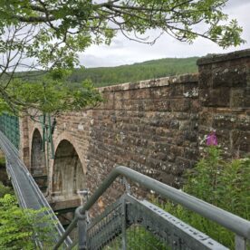
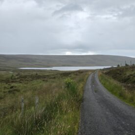
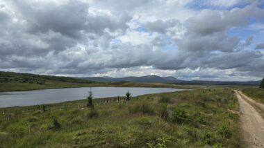
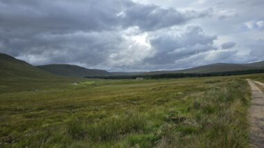
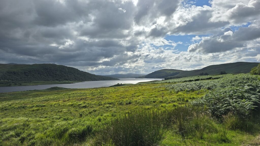
From here it was back on the road again past Loch Merkland, and onwards to Loch Shin. At Cassley, I pulled off the public road onto the hydro road, having still not seen a car all day! A short loop around the end of Loch Shin brings you to a tough climb ever upwards to the transmitter close to the summit. It remains on tarmac, which although easier means there is nothing to take your mind off the pain in your legs!
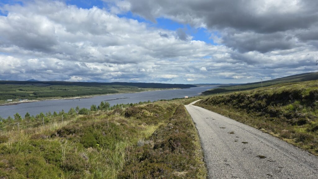
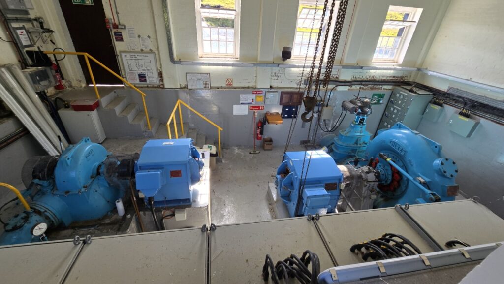
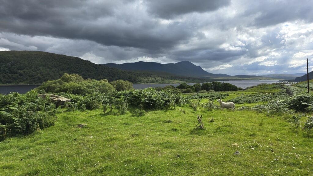
From the summit, unfortunately still on tarmac, a descent takes you down to the hydro station at Duchally, From here there are nice views into the back of the Assynt mountains.
Back off off road for a short section here before the trail joins the end of the long road down Glen Cassely to Rosehall. The scenery remained lovely.
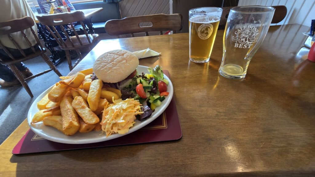
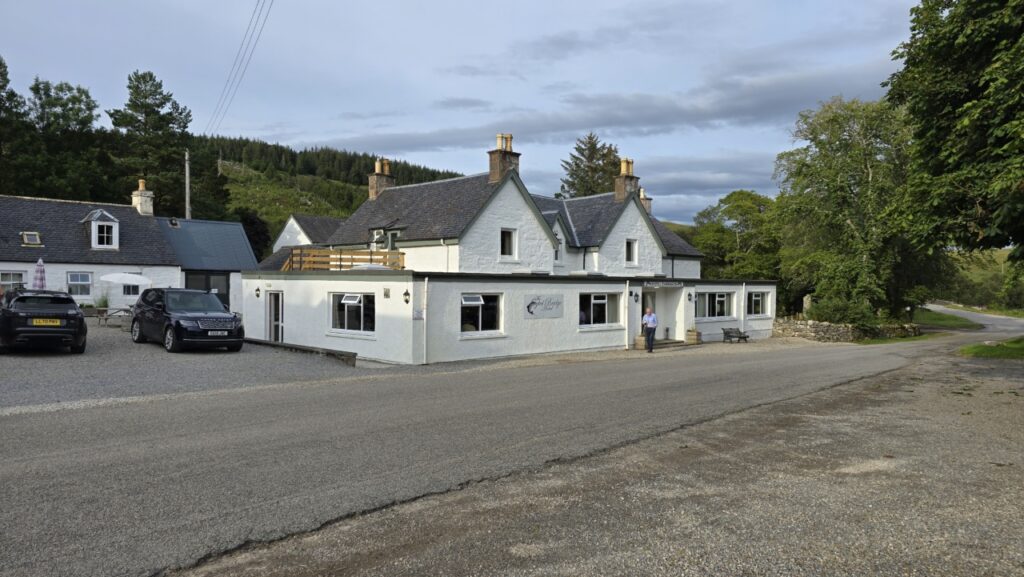
Upon reaching Rosehill, my thoughts had turned to those involving the stomach. A beer and a burger were seriously called for!! The climb between me and my burger was frankly uncalled for (!), but I made it and tucked in!
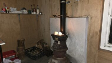
Suitably fuelled, and with it already being 7PM, I made haste on the final 16KM to the bothy which was all off-road. There were a mix of folks in the bothy, some doing An Turas Mor, and others there with the same plans as me for the following day: Seana Bhràigh. The midgies were utter rife and I was not jealous of the folks who had chosen to camp at-all! I managed to score me the wee room to myself and got a decent nights sleep!
Day 2 – Schoolhouse to Creag Mohr bothy (via Seana Bhràigh)
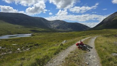
Day two dawned just as un-Scottish as day one with another blazing blue sky. Seana Bhràigh involves a detour further down the glen, and since I had not worked out my exact plans I just took all my kit with me. I cycled some of the way with a friendly estate-hand who was using an E-MTB as an alternative to his usual pickup.
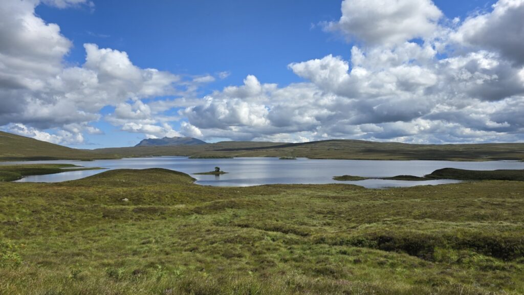
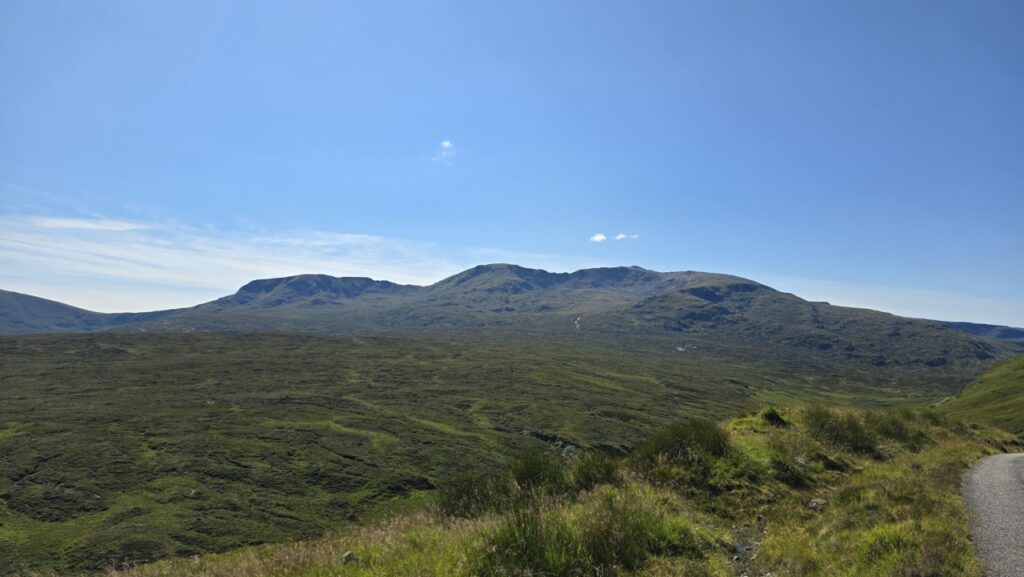
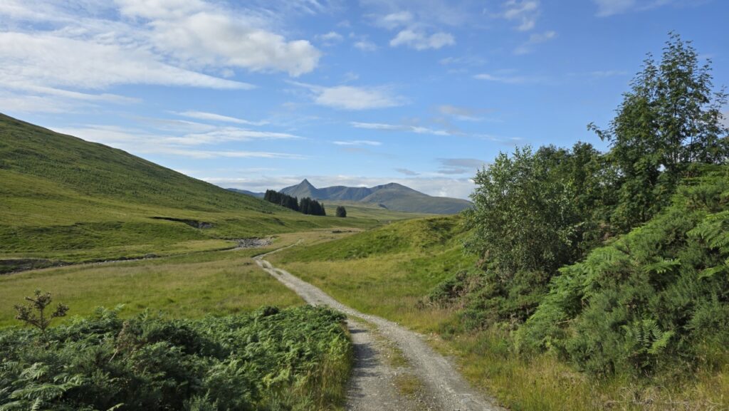
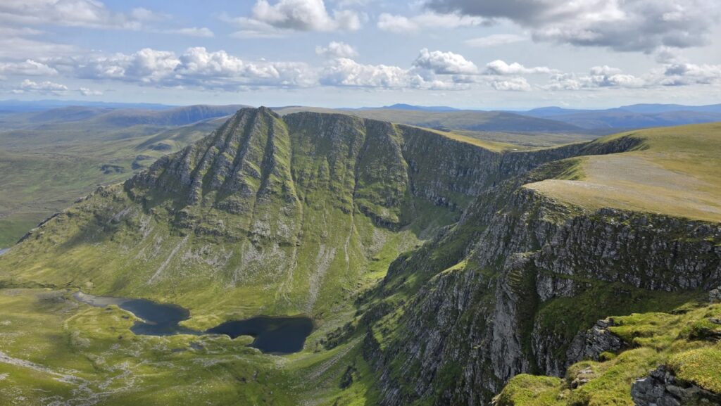
The track continues along Strath Mulzie for about 8KM, with the unmistakable shape of Seana Bhràigh front and center. Eventually I reached a handy point to abandon the bike.

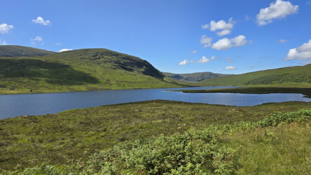
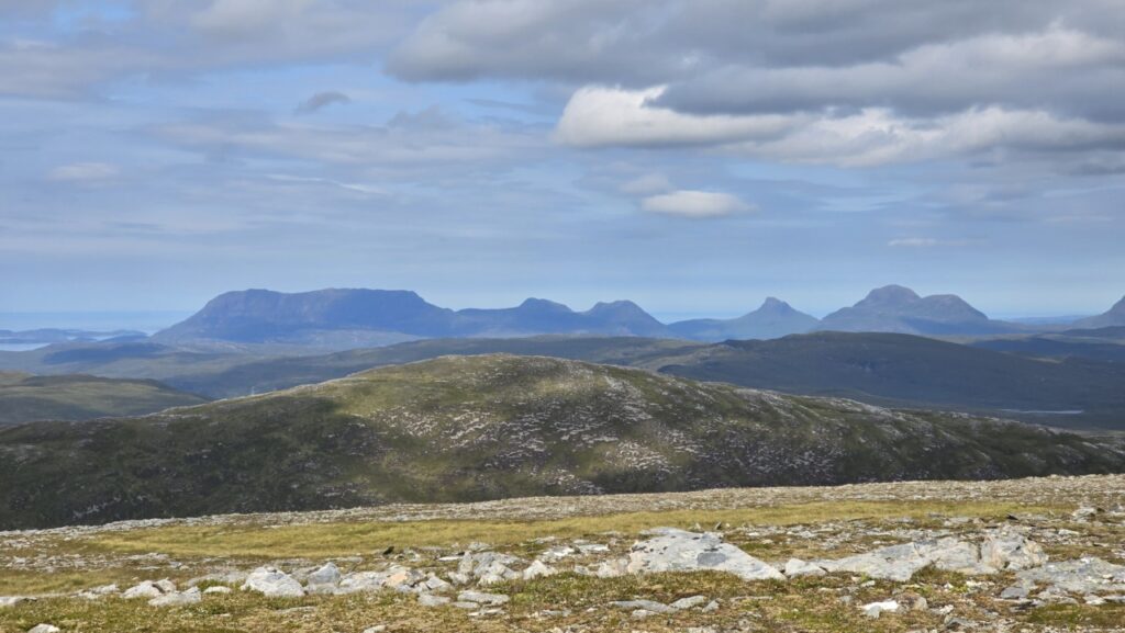
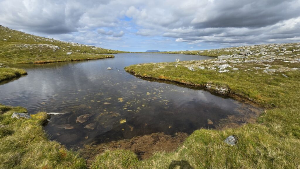
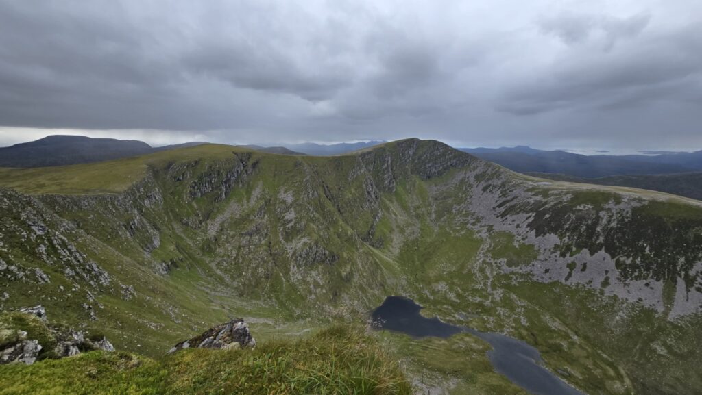
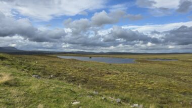
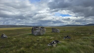
After the initial climb I reached a lovely wee unnamed lochan at 760M, where I paused to take in the views towards the Assynt hills.
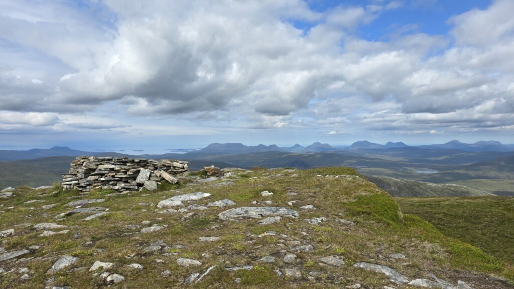
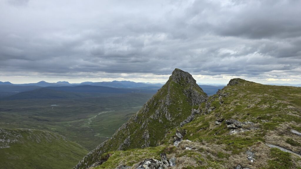
The ‘pointy bit’ you can see in the earlier photos is not the summit of this Munro, but as its most prominent feature it was definitely worth a visit. There is actually a scramble that takes this more direct, but being fairly remote, and solo I took the standard route. Having bagged the actual summit, I traversed around and found a somewhat steep route that got me on top of said ‘pointy bit’!
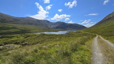
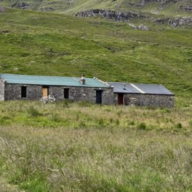
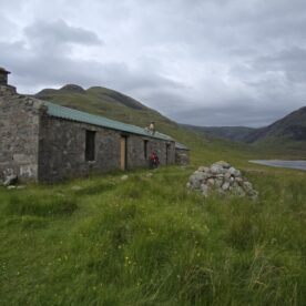
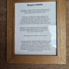
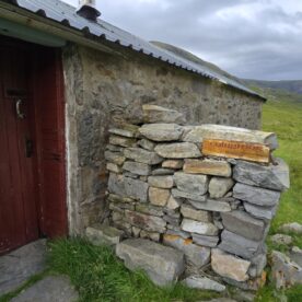
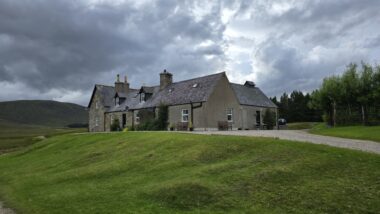
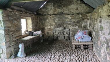
I retraced my route back to the bike, and set off again for an exploratory further along the glen. At the end of the track are two bothies: Magoo’s (an estate bothy), and Coiremor (an MBA bothy) located either end of the same building. Both are open to the public and Magoo’s in particular was rather well appointed. I lucked out rather at Magoo’s, someone had left 4 cans of beer and 2 cans of cider on the table together with a load of packeted food. No other kit to be seen as well as the positioning of said stash indicated it was for the taking! The amount of packeted food left in Scottish bothies could probably keep a MTB-stravaiger fuelled, however you would need to really love supernoodles!
I had decided not to stay here this eve as it would have made the following day an utter monster, but since I was not going past any shops en-route to ‘my’ bothy a couple of those beers went into my bag!
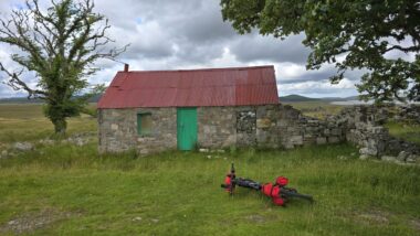
Back on the move, 10KM on the bike saw me back at School House Bothy, I half considered staying here, but the thought of tomorrows monster ride made me keep going another 5KM or so to my rather less salubrious overnight accommodation: Creag Mohr bothy (a basic estate bothy).
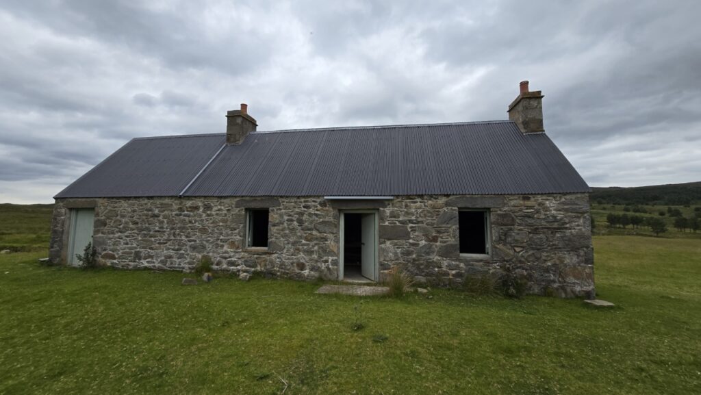
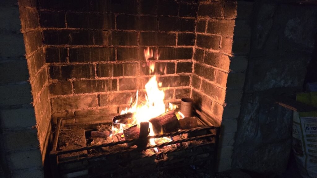
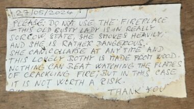
Creag Mohr was windowless, but well situated next to a river, and featured a breeze to keep the midges off which allowed me to open the shutters. There was also some wood nearby so I had me a lovely solo evening watching Bothy TV, while drinking free beer. Does life get any better?!
Day 3 – Creag Mohr Bothy to Loch Choire Bothy
Today was going to be a monster. Thus far my route had made use of well known trails, but today would take in a long stretch about which I could find little information. I expected some hike-a-bike, I just did not know how much!
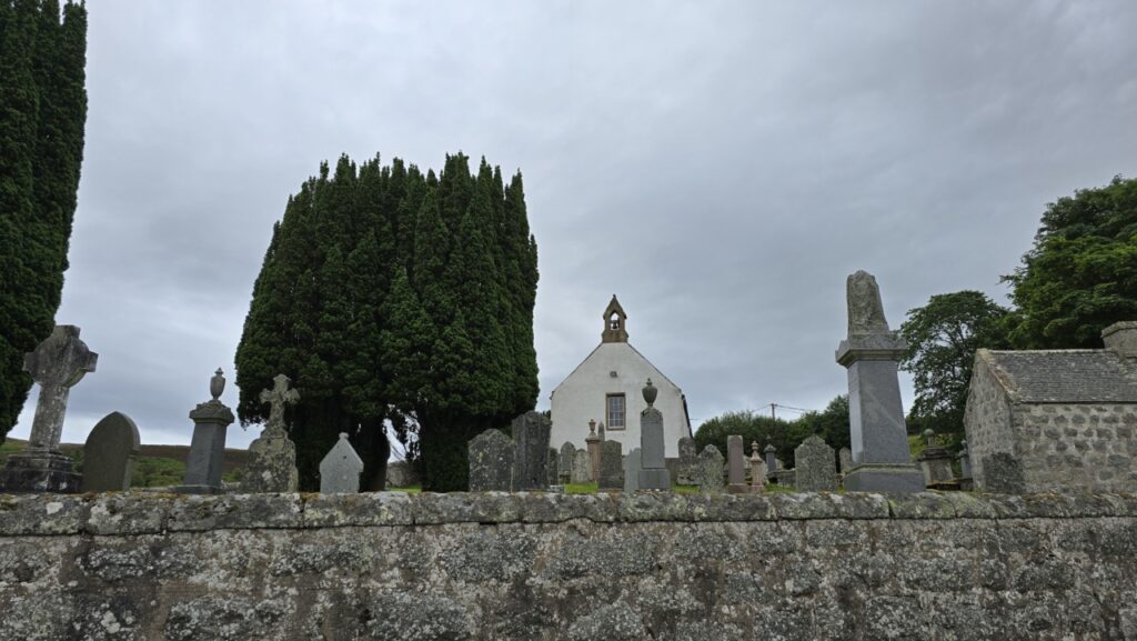
I set off heading for Croick, with its pretty wee church, meeting a friend coming the other way in the process. I knew he was doing An Turas Mor, but had not actually expected our paths to cross.

As I approached the Kyle of Sutherland, I headed north, mainly so I could cross the Kyle on the cycleway come footpath that runs next to the railway. On the other side, I was supposed to be heading north to Lairg Station to pick up the track past Loch Laro, but I had heard good stories about the cafe in Bonar Bridge. I am an absolute sucker for a decent chunk of cake, so south I went…
Fully caked up, I took the minor road from Bonar Bridge up to Loch Buidhe, going past where the track from my intended route would have popped out. (I will return one day and recce this bit).
Eventually, I was unceremoniously spat out onto the A9 (bit of a shock to the system!). Thankfully, the A9 stint lasts only for 1KM before a left turn brought be to Rogart and the start of another climb.
From Rogart, Sciberscross was my new aiming point, thankfully back on quiet roads again, with plenty interest to take my mind off my tired legs.
At Sciberscross its back off road again for the 10KM to Ben Armine Lodge, and the unknown hike-a-bike that likely lurked beyond! This was completely new territory for me as my munro/corbett bagging habit had not taken me to these parts before.
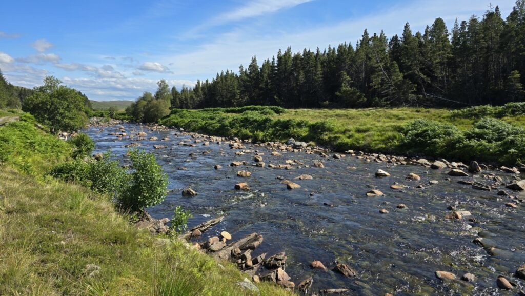
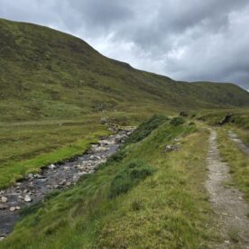
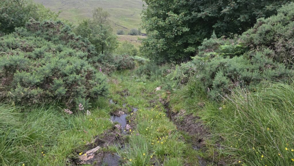
The lodge looked deserted, and my bothy for the night was still about 15KM away, so I ploughed on. I took the track under the trees rather than through them, following the Black Water upstream. The initial section was pretty bikeable, then it turned into an unrelenting bike shoving exercise (as expected)!
After a couple hours of bike shoving along the boggy track, another ‘track’ which must have been a figment of the cartographers imagination heads west on the map. By this point, I was running on Mentos (sweets), and had considered just crawling into my bivvy bag a few times, alas the thought of a bothy rather than a bivvy spurred me onwards!
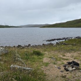
I waded across the river, and then began shoving my bike over open moorland finding only remnants of bridges where the marked track should have been. Eventually, and with some relief, the high point was reached.
The ‘track’ down the other side towards Loch Choire did not look like much cop, but a fully loaded bike and gravity helped rather, and I actually made pretty good progress, until that is the track comes to an abrupt end!
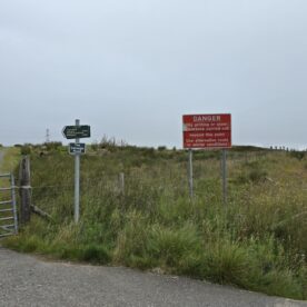
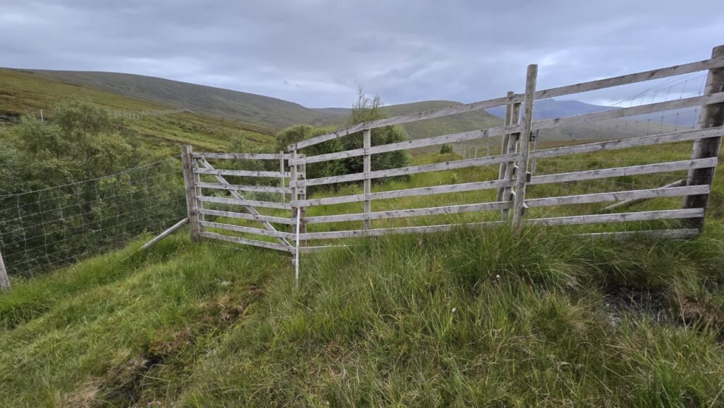
At some point, you reach a gate, which does not really open. Rather than unload the bike to get it through the gate, I pushed down the right hand side of the fence. Lower down it became clear that the gate had served to keep the deer out, but this had allowed thick gorse bushes to take hold. I was glad not to have gone through the gate!
Lower down, after much bike shoving, and with the weather deteriorating rather an unlikely track led me down to the left. Thankfully, this got better and soon enough, I was on the home stretch to the bothy in the distance!

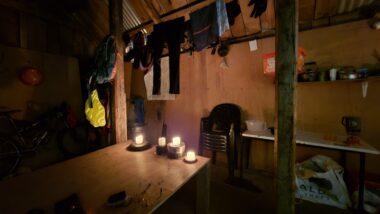
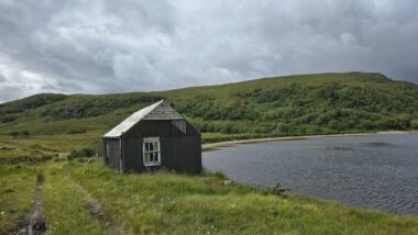
I burst through the door to the bothy, bike and all, and got me some scran going. Once I had eaten that, I got me some more scran on, and then ate a load of cakes I had bought in Bonar Bridge. Pure piggery, but double portions were most definitely needed today after 13 hours riding (and shoving!) the bike. If any one else does this section, it is worth it – for the linkup, but don’t under-estimate it! This bothy also goes by the name ‘Albert Grant Bothy’ it seems.
I became quite fond of Loch Choire bothy overnight as the weather was wild, I was glad not to be kipping in a bivvy bag in a swamp!
Day 4 Loch Choire Bothy to the Van (Altnaharra)
The next day, before leaving I was able to use the provided facilities (bucket, bowl, loch) to freshen up for my return to civilisation, I was also back on a mostly ridable track. I bid farewell to my trusty home for the night, vowing to return some day.
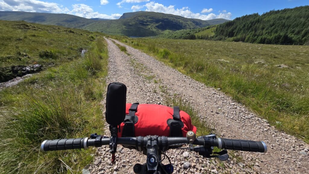
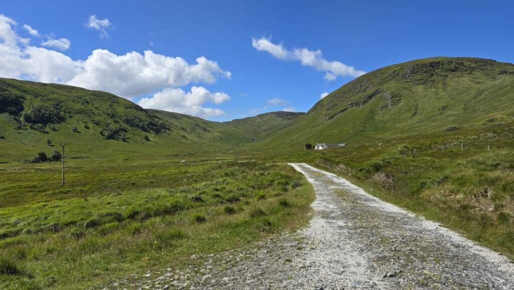
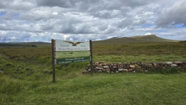
The 4KM along the loch-side track were not exactly fast, but a breath of fresh air after yesterday. Beyond Loch Choire House, the B871 is an easy 15KM cycle on decent tracks. On the way, I popped into Gearnsary (also an estate bothy), nice setting, but the bothy its-self was pretty ramshackle.

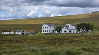
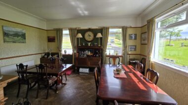
The B871 is one of those roads that see’s traffic roughly every hour, and made for fast progress north. It would have been rude of me not to visit Garvault House (apparently the most remote hotel on the mainland). I enjoyed some oldie worldie tea and cake served by a guy whose attire would not have looked out of place 300 years ago – ditto the room!
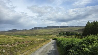
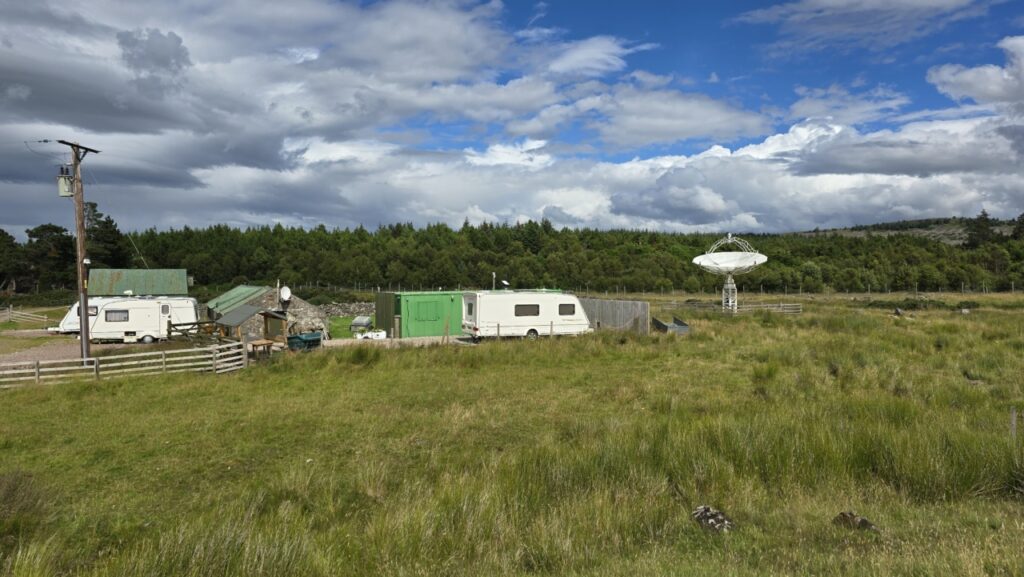
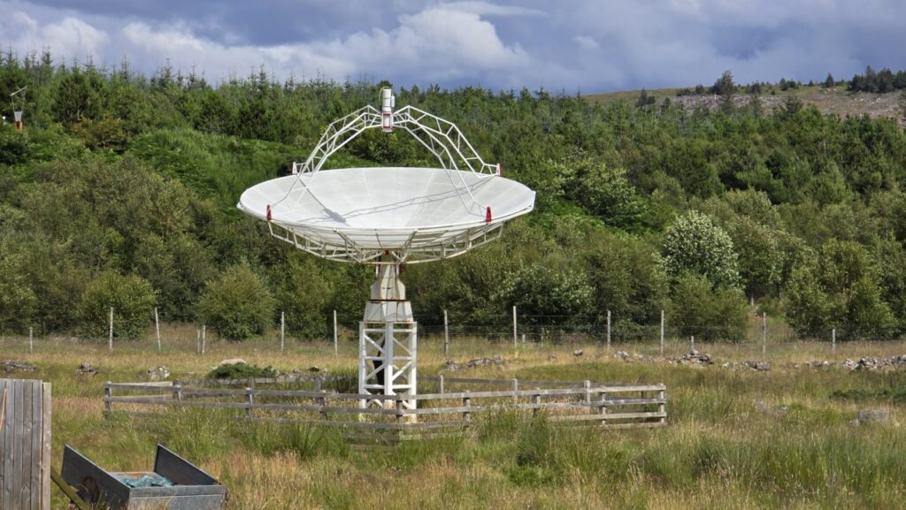
I continued on the B871 now heading west for a further 8KM until I reached a track on the left past the obvious transmitter tower. Glad to be off-road again, I continued to the left turn leading to the caravans at Dalharrold. I don’t know whats going on here, but they were well connected, these caravans with Starlink internet and a bloody great dish that looked like it should be communicating with probes orbiting Mars!
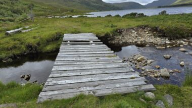
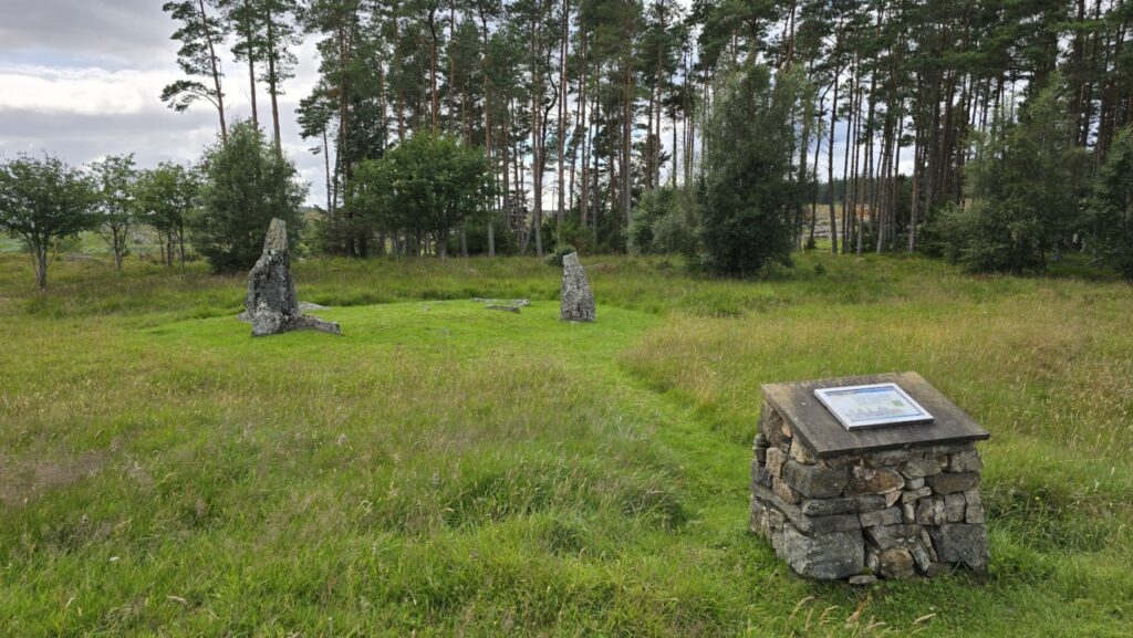
There is a ford here across the River Naver, but I doubt its ever fordable on a bike. It would have been a crotch high wade today, which I didn’t fancy. I re-traced my steps to the previous junction and continued along the track now heading north on the wrong side of the River Naver. There are several info boards around here covering the Strath Naver trail, and the highland clearances in these parts. There is also an area of standing stones. Marked on the map are several bridges, but I believe these are for fisher-folk to access the opposite bank (from the road) and it looked like hard graft to get to them from my side with a bike.
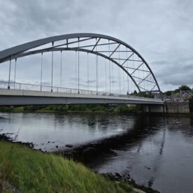
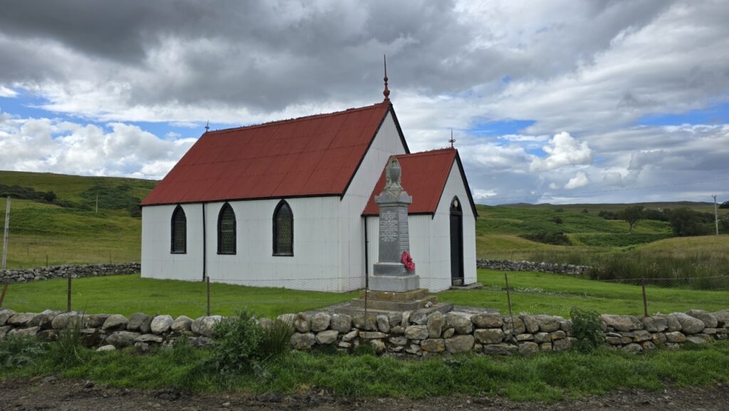
Another 5KM see’s you spat back out onto the B871, where a left turn takes you over the river Naver and south on the B873 – aka the home run! There is no real alternative to the road here, but at least the scenery was decent. I stopped to take some pics of a pretty church at Syre.
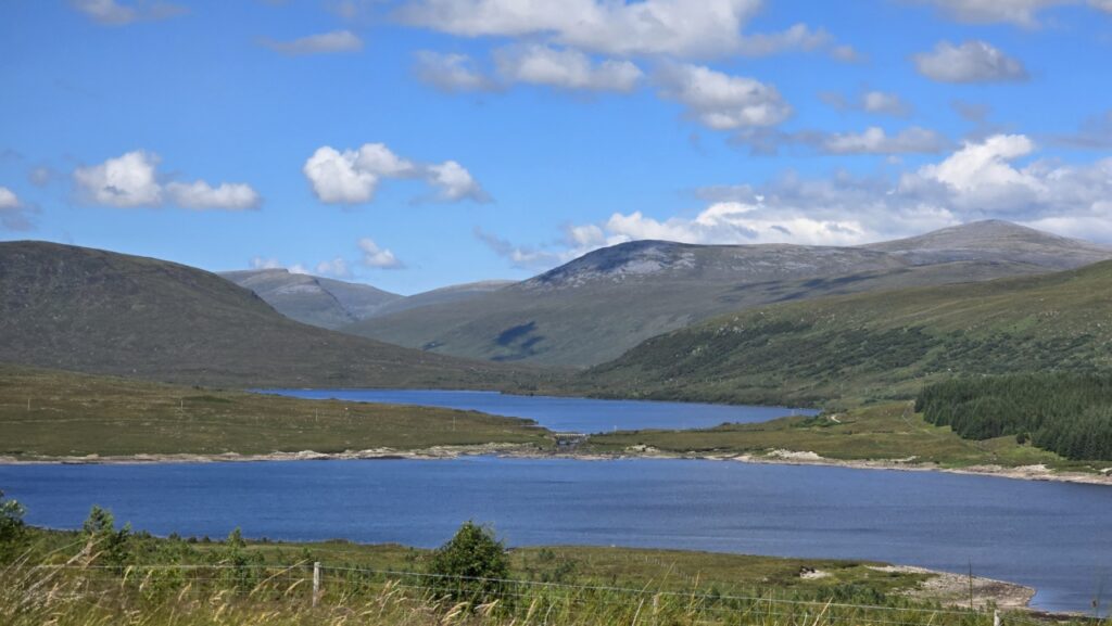
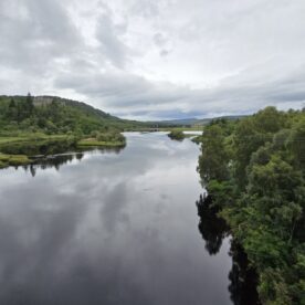
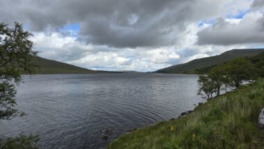
The road back to where I started from runs alongside Loch Naver, I was salivating by now for a can of coke and an Ice Cream that were in the van! Thankfully the van delivered on my desires.

Epilogue
I reckon my first ever bike packing trip was a resounding success overall. My route delivered an entertaining if tiring 3 days on the bike combined with a days munro bagging, and some spectacular scenery. Starting at Altnaharra meant that I was able to use bothies each night, while keeping the distances about the same.
Later in 2024 I did a couple more circular 3-day bike packing routes, and I have desires to do the Badger. The full ATM route will probably have to wait until retirement in a year or so.
Kit
Really love the Aeroe handlebar mount and rear rack. No shuggling was the goal, and no shuggling was what it delivered. Unusual for me to buy the right kit (for me) from the get-go. The only change I needed to make was to swap out the clippy nylon straps with some quality Voile rubberised straps – this made mounting dry bags a speedier process.
My bike is ancient, in fact the only thing that’s original is the frame, handlebars and stem. The bike owes me nothing and seems to work pretty well as a bike-packing steed – esp with the 1×11 upgrade I added just before this trip.
My Route
My route is here on Komoot: https://www.komoot.com/tour/1696311408
To avoid surprises for anyone else wanting to do the same, the route is presented exactly how I did it, excluding the hillwalking section up Seana Bhràigh, but including the detour out to Magoo’s Bothy. It totals 290KM with 2800M of up. If you omit the detour out to Magoo’s, this reduces to 270KM with 2600M of climbing. You would be missing out on a spectacular glen though, and Seana Bhràigh is deffo worth the effort 😉
The route is non-technical, the most technical sections being the boggy section on day three and the ride along Loch Choire on day 4. I believe that the boggy bits and the descent down to Loch Choire are better erm ‘enjoyed’ on a mountain bike rather than a gravel bike (!).
Alternatives
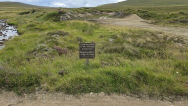
As mentioned in the text, I had intended to head up to Lairg Station after Invershin, and take the track across to Loch Laro, before popping out on the minor road near Loch Buidhe (NH 645 966). This track follows new powerlines. The map shows ~200m of hike-a-bike on the top before reaching Loch Laro at the crossing of the ‘Alt na Fearna Mor’ burn.
great write-up and you met some wonderful people as well 🙂